
Description
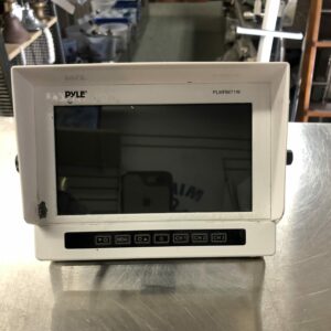
Easy to use GPS chartplotters with 5″ backlit 320 x 240 pixel screens: FX 324 MAP is black and white, FX 324 MAP Color offers a colour screen that is highly visible in direct sunlight. Both models feature a built-in worldwide basemap of coastlines and support the new MapSend BlueNav marine charts in secure digital memory cards. 12-parallel channel WAAS and EGNOS enabled. Waterproof. Ships with external antenna.
Utilizing MapSend BlueNav Charts the FX324 MAP and FX324 MAP Color enable you to scroll seamlessly through these intelligent vector charts, with numerous details and a huge amount of information, such as an extensive list of marinas. Worldwide cartography is available on MapSend BlueNav Secure Digital (SD) cards, making your FX324 MAP endlessly expandable. SD cards also enable you to save your navigational data such as waypoints, routes and tracks. FX324 MAP and FX324 MAP Color with MapSend BlueNav Charts dynamically deliver all your valuable navigation information, including tides at local ports, currents, maps and available services at ports, navaids, and more.
• Easy to use An intuitive interface and large, backlit keyboard provides direct access to key features and information like position, speed, course plotting, event and man overboard waypoint marking, providing added enjoyment and safety to your adventure. Instantly access your key features:
POS
The POSITION screen displays all the important information you need regarding your position, your speed and your course over the ground.
NAV
The NAVIGATION screen displays your speed, your course over ground, (both in extra-large alphanumeric characters), two odometers and another piece of information of your choice.
GOTO
The GOTO screen helps you get to a predefined waypoint or to follow a route. It’s your pilot, and you can select the way you want information to be displayed among the four display options available: Compass, 3D-Road, Radar or Data.
PLOT
One touch of the PLOT button displays the selected MapSend BlueNav chart you have loaded, enabling you to follow your route as you track your position on the screen. You can easily backtrack whenever you want.
MENU
The MENU key takes you directly to the menu screens. One touch and you get your position, one glance and you see where you are on the detailed chart displayed on the screen.
MARK/MOB
The MARK/MOB key offers the additional safety of direct priority access to the man-overboard function and is also used to mark event waypoints.
FX MAP 324
FX MAP 324 Color
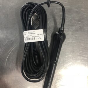
Ships with: External Antenna, Face Plate Protector, Mounting Bracket, Power Cable
satisfaction
• Full Featured Navigation Select from 26 sets of navigational information. Customizable graphic navigation displays show a 3D road, compass, radar, and text readouts of COG, SOG, bearing and distance, XTE, ETA, and more. Choose from 12 built-in types of coordinates including Latitude/Longitude, Universal Transverse Mercator, Military Grid Reference System. and 76 map datums (Europe 50, WGS84, WGS72.). With direct access to key features and self-explanatory graphical icons, navigation couldn’t be easier.
• Complete software 1000 waypoints with name, comment and icon, date and time – 30 reversible routes of 50 waypoints with total length, details of route and waypoint advance – 6 tracks of 1000 points.
• Safety first! If facing an emergency, don’t lose any time: the bright red MOB (Man Over Board) button, can be rapidly activated by any member of the crew, including children. FX324 MAP instantly memorizes the position of the event and guides you directly to where you marked the spot. Use the same button to activate the MARK function, instantly memorizing route waypoints or anchoring waypoints.
• Accurate 12 parallel channels simultaneously track up to 12 GPS satellites. Horizontal position and speed accuracy with WAAS/EGNOS: < 1 meter (3'2") 1RMS (2D); +/- 0.1 Knot. • Tide functions Get the tide timetables, height of water and tide coefficients applicable to the date of your choice and the port you want to reach. You can also graphically view these levels and set them to reflect your draft. • Satellite status Monitor the GPS satellites in view and get information about their status. • Large backlit display The large, high contrast display provides read outs that are easy to read in bright sunlight or even at night. • Rugged construction Impact resistant plastic allows you to confidently take your FX324 MAP or FX324 MAP Color on that next great adventure. • Waterproof The FX324 MAP/FX324 MAP Color is sealed to IEC-529 IP67 specifications. • Multiple language support Software is available in French, English, German, Spanish, Italian, Dutch, Swedish, Danish, Norwegian, Portuguese and Finnish.